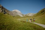
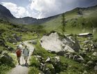
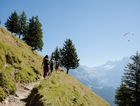
A varied network of scenery hiking trails is easy accessable on Allmenalp.
A real highlight are the hikes to First as well as to Bunderspitz and for sure to the Alpschelehubel. The three summits can easily be reached on foot without additional equipment.
Hikers along the “Via Alpina” could continue towards Alpschelegrat and Bunderchrinde - or via Bunderspitz towards world-famous town of Adelboden.
Those who prefer a more leisurely pace, but do not want to miss the magnificent views over Kandersteg, hike from Allmenalp top station in the direction of the Ueschinen valley and back to Kandersteg.
Trails from Allmenalp
| Route | Time | Level | Map | Highlight |
| Allmenalp – Ryharts | 40 Min. | simple | (1) | Viewpoint! |
| Allmenalp – Ueschinental | 1 Std. 10 Min. | simple | (A) | |
| Allmenalp – Alpschelehubel | 2 Std. 30 Min. | intermediate | (2) | Viewpoint! |
| Allmenalp – Bunderspitz | 2 Std. 45 Min. | intermediate | (3) | Viewpoint! |
| Allmenalp – First | 2 Std. 50 Min. | intermediate | (4) | Viewpoint! |
| Allmenalp – Kandersteg via Ueschinental | 2 Std. 30 Min. | intermediate | (A) | |
| Allmenalp – Kandersteg via Pfadizentrum | 2 Std. 15 Min. | intermediate | steep! | |
| Allmenalp – Kandersteg via First und Golitschenalp | 5 Std. 50 Min. | dificult | (4) / (B) | |
| Allmenalp – Adelboden via Bunderspitz | 4 Std. 30 Min. | dificult | (3) |
Find the operating status (open/closed) for hiking trails here!
Hiking is happening outside! Please prepare your next hike in advance.
- Prepare your route, know where to go.
- Choose your hike wisely. It should fit your level of fitnes and your abilitys.
- Wear good hiking boots.
- Protect yourself from heat and sun as well as from cold and rain.


